Original research article

This study was carried out to classify country-wide areas of paddy rice cultivation using sentinel-1 SAR (synthetic aperture radar) imagery. Rice production with adequate level of area is important for decision making of rice supply and demand policy. It is essential to grasp rice cultivation areas in advance for estimating rice production of the year. Time-series Sentinel-1A and 1B images acquired from early May to early July were processed to convert into sigma naught (dB) images using SNAP (SeNtinel application platform) toolbox provided by European Space Agency. Farm map and parcel map, which are spatial data of vector polygon, were used to stratify paddy field population for classifying rice paddy cultivation. To distinguish paddy rice from other crops grown in the paddy fields, threshold levels were determined for each image based on crop calendar and backscattering coefficient range of paddy rice and other crops, and applied for the images to make theme maps with “1” for rice and “0” for other crops. Theme map layers were stacked to make one image and the each threshold value was applied to the theme map for rice classification. The classified areas of rice cultivation in 2020 under the stratification of three different paddy field population, 1) whole farm map, 2) farm map with paddy and plastic film house, 3) parcel map edited by LX, were 716,683 ha, 621,778 ha, and 641,679 ha, respectively. Reference data with spatial information need to be developed using farmhouse management and farmland boundary information. Image classification methods need to be attempted for further studies.
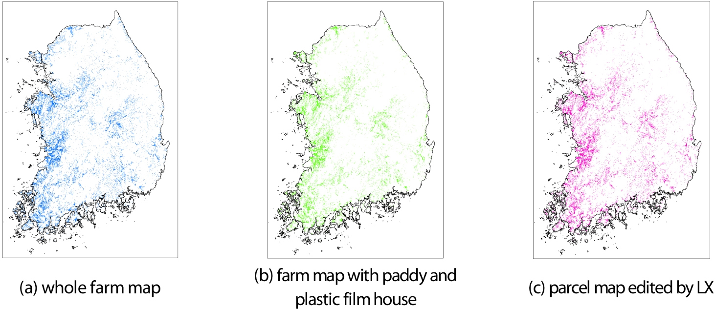
Maps for paddy rice cultivation areas classified from Sentinel-1 imagery using different rice paddy
- Publisher :Korean Society of Soil Science and Fertilizer
- Publisher(Ko) :한국토양비료학회
- Journal Title :Korean Journal of Soil Science and Fertilizer
- Journal Title(Ko) :한국토양비료학회 학회지
- Volume : 53
- No :3
- Pages :345-354
- Received Date : 2020-08-13
- Revised Date : 2020-08-24
- Accepted Date : 2020-08-25
- DOI :https://doi.org/10.7745/KJSSF.2020.53.3.345
 Korean Journal of Soil Science and Fertilizer